
DEWLINE HISTORICAL DESCRIPTION
Topography
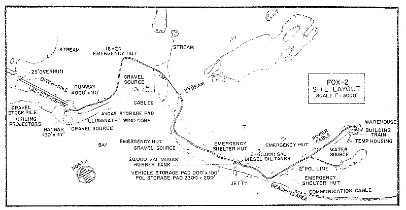
- FOX-2 at LONGSTAFF BLUFF, Canada, is situated on a ridge at an altitude of approximately 500 feet. This Auxiliary Radar Station occupied 4169 acres of land. The general area in the vicinity of the station is characterized by a series of parallel east-west ridges having an average elevation of 350 feet. When approached from the air, the terrain appears to be corrugated. The bluff projects about 10 miles southward in the form of a blunt nosed tip below the neck of Baird Peninsula
Climate
- Annual precipitation, including snowfall is approximately 8 inches, being heaviest from July to October, and least from December to March. Snowfall is greatest in October and November and averages about 44 inches a year. The absolute minimum and maximum temperatures are minus 53 and plus 75 degrees Fahrenheit respectively.
Water
- A round trip potable water haul of 3 miles is maintained summer and winter.
PHOTOS
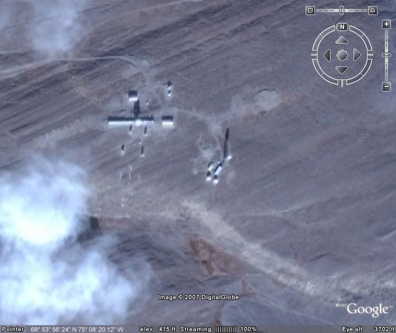
Satellite Image Closeup.

Site photo courtesy Dan McIsaac.

Recreation Module. Note the fox and the two glasses on the front of the bar denoting FOX-2. Courtesy Brian (Simon) Jeffrey.

Taken back of the SRR bldg. looking towards the old DEW line site. Courtesy Dan McIsaac.


Construction Era Photos for FOX-2.
The pictures below were selected from the extensive collection of Markham Cheever, the DEWLine’s Superintendent of Construction from 1953 to 1957, before the Line went operational. (Click on picture to enlarge.)
-

- A Caterpillar D-4 tractor being para-dropped onto the site. March 1955.
-

- Erection tent where the modules are to be assembled. Nov 1955.
-

- Footings for the module train in the upper right and the form for the radome at the left front. Nov 1955.
-

- Aerial view from the North of the radome-less module train. April 1956.
-

- The platform that will hold the radome can be seen. Note the series of living tents along the road at the left of the photo . Aug 1956.
The People.
The people in the photos below, also from the Markham Cheever collection, are displayed in the hopes that someone may recognize a father, grandfather, or friend who was involved in the construction of this particular DEWLine site. (Click on picture to enlarge.)
-

- L to R: Bert Fuller and Hugh Amor. July 1955.
-

- C. W. Walker. Feb 1957.