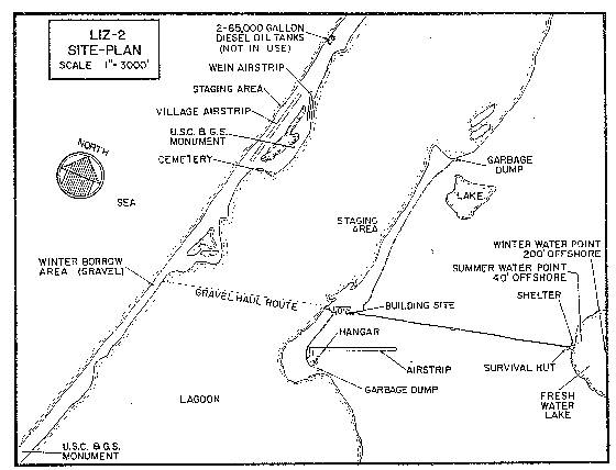
DEWLINE HISTORICAL DESCRIPTION
Topography
- LIZ-2 at POINT LAY, Alaska is situated on 2875 Acres of low lying tundra covered terrain at an altitude of approximately 20 feet above sea level. This Auxiliary Radar Station is the westernmost site of the DEWLine. It is located on the northwest coast of Alaska facing Kasegaluk Lagoon some 100 miles east of Cape Lizbourne and 25 miles west of the Utukok River. Low, rounded tundra-covered hills are the most distinguishing topographical feature of this area.
Climate
- Annual precipitation, including snow fall is approximately 4 inches, being heaviest from July to October. Snowfall is about 27 inches a year. Mean daily temperatures run between a minimum of 4.2 to a maximum of 15.9 degrees Fahrenheit above zero.
Water
- A 3 mile round trip potable water haul is maintained summer and winter
NOTE: Site was deactivated in 1994
PHOTOS

Satellite Image – High level.

Satellite Image – Close-up.

Site sign. Courtesy Chad Garber.


Construction Era Photos for LIZ-2.
The picture below was selected from the extensive collection of Markham Cheever, the DEWLine’s Superintendent of Construction from 1953 to 1957, before the Line went operational. (Click on picture to enlarge.)

The fully assembled module train with the generators running but before the radome and radar antennas were installed. March 1956.
The People.
The person in the photo below, also from the Markham Cheever collection, is displayed in the hopes that someone may recognize a father, grandfather, friend, or in case of this this photo, a family member, who was at this particular DEWLine site. (Click on picture to enlarge.)

While not a construction worker, I couldn’t resist including this picture of a young Eskimo (Inuit) girl with bubble gum. Circa 1955.
