
DEWLINE HISTORICAL DESCRIPTION
Topography
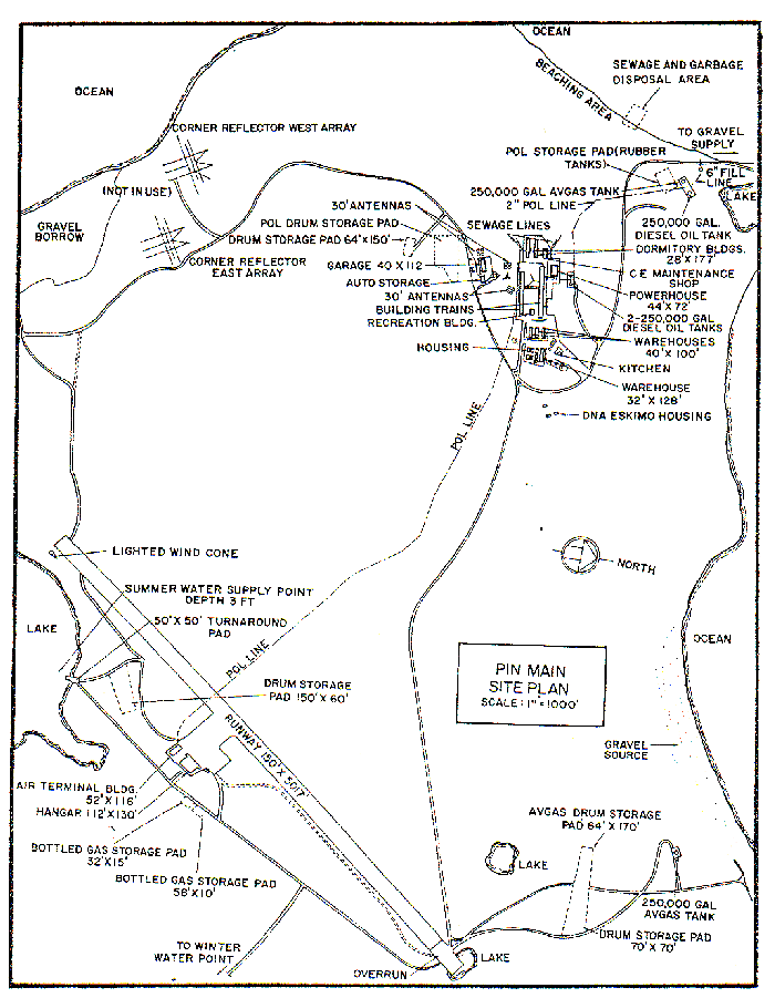
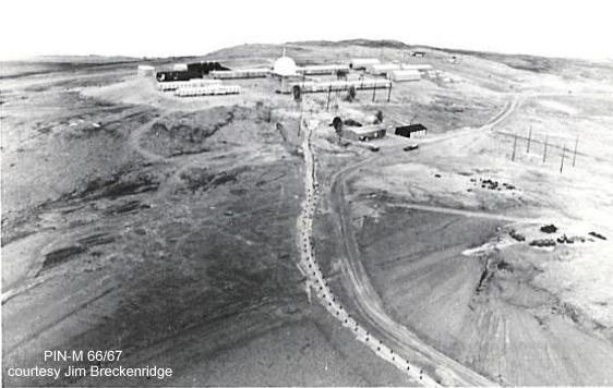
- PIN-MAIN at CAPE PARRY Canada, is situated on Parry Peninsula about 2 miles northwest of the narrow isthmus connecting it to the mainland of Amundsen Gulf. This Main Radar Station is located on top of a hill at an altitude of about 250 feet above sea level. there are 2607 acres available for use by PIN-M. There is a military-manned Data Center, but no contractor sector headquarters group at this site.
Climate
- Annual precipitation, including snowfall, is approximately 8 inches. Snowfall is about 49 inches a year. Absolute minimum and maximum temperatures are minus 47 and plus 74 degrees Fahrenheit respectively.
Water
- The round trip potable water haul in summer is 3.5 miles and in winter 6.5 miles.
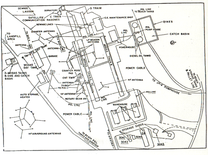
Site Building Layout Diagram.
PHOTOS
Click to enlarge.
-
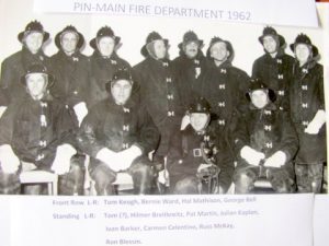
- Volunteer fire department, courtesy Ron Blessin.
-
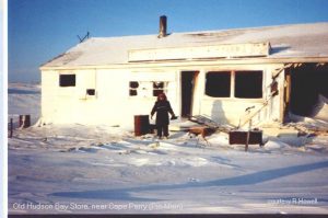
- The old Hudson’s Bay store near PIN-Main. Courtesy Ralph Howell
-
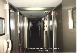
- A view down the “B” train (sleeping quarters). May 1989.
-
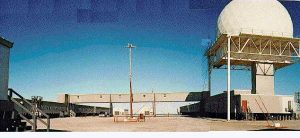
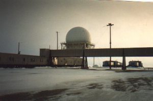
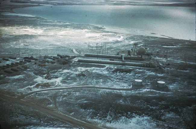
- PIN-Main, 1981/82. Courtesy Adrian Fowler.
-
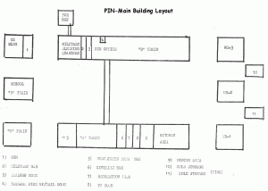
- Diagram showing the PIN-Main building layout.
-
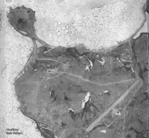
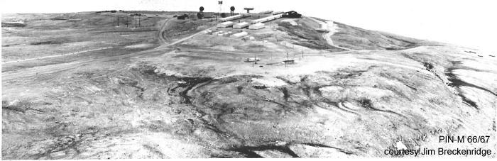
- Aerial photo, irca 1958. Courtesy Bob Wilson.
-
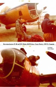
- The civilian P-38 that took the aerial photo on the left. Courtesy Bob Wilson
-
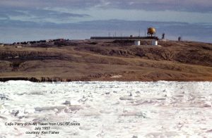
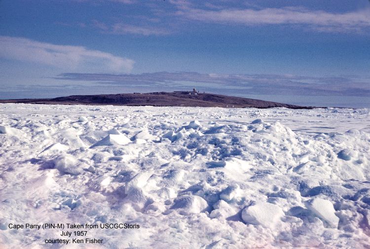
- PIN-Main as seen from the USCG Cutter Storis. July 1957. Courtesy Ken Fisher.
-
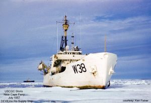
- USCG Cutter Storis near Cape Parry. DEWLine re-supply ship, July 1957. Courtesy Ken Fisher.
Full size photos (below).
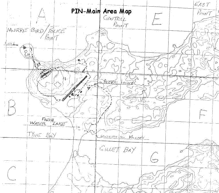
Local area map showing Murre bird sanctuary/Police Point.
Construction Era Photos for PIN-Main.
The pictures below were selected from the extensive collection of Markham Cheever, the DEWLine’s Superintendent of Construction from 1953 to 1957, before the Line went operational. (Click on picture to enlarge.)
-
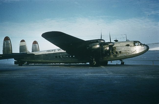
- Pacific Western Airway’s York CF-HIP. May 1957.
-
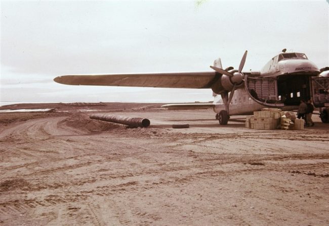
- Bristol Freighter disgorging construction material. June 1955.
-
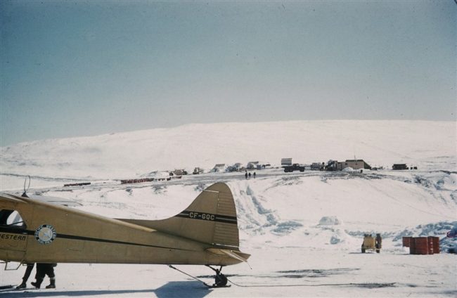
- Pacific Western Airway’s CF-GQC with the advanced camp in the background. May 1955.
-
- The almost completed module trains awaiting the radar antenna and radome with the construction camp shown on the left. June 1956.
-
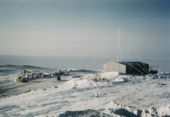
- Station garage with the emergency radio antenna. March 1956.
-
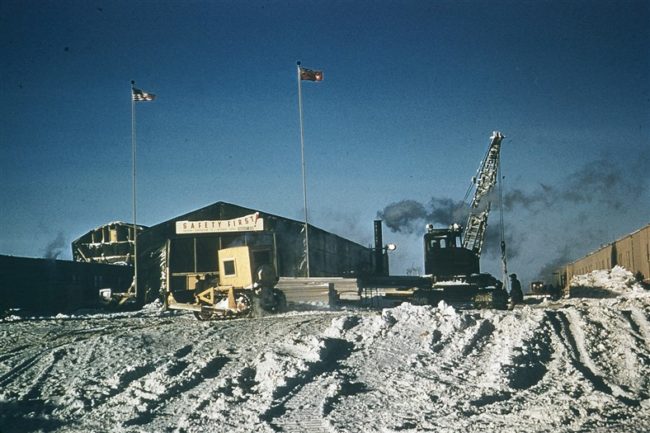
- The erection tent with its safety sign. This is where the modules were constructed. March 1956.
-
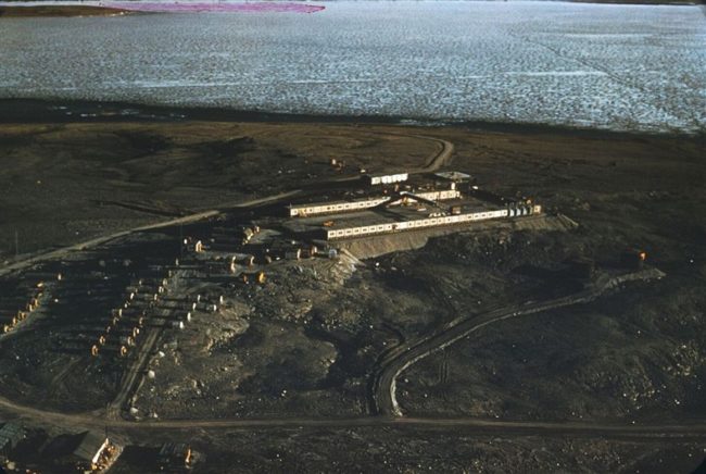
- The onset of winter showing an almost completed station with the construction camp on the left. Oct 1956.
-
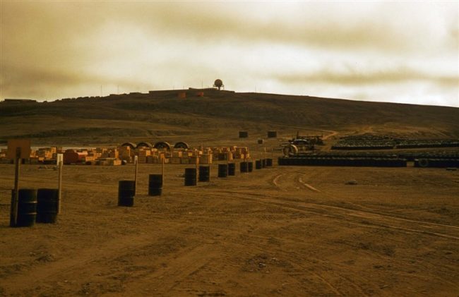
- View of the site from the beach storage area. Aug 1956.
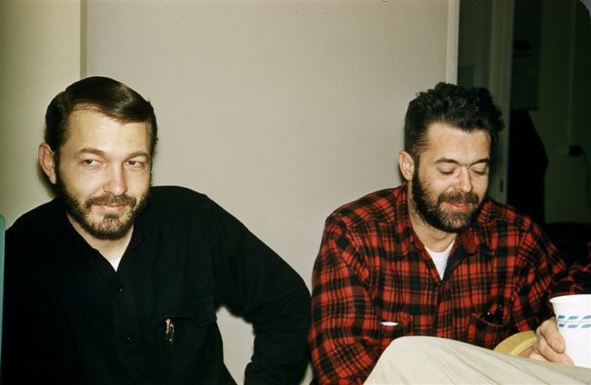
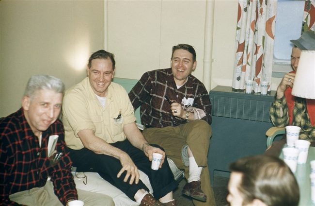
The People.
The people in the photos below, also from the Markham Cheever collection, are displayed in the hopes that someone may recognize a father, grandfather, or friend who was involved in the construction of this particular DEWLine site. (Click on picture to enlarge.)
-
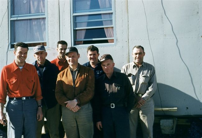
- L to R: Cheever, Hoppe, Hutch, & Allenson. March 1956.
-
- L to R: Moore, ?, Marsin, Danney, Wills, Hoppe, & Evers. June 1955.
-
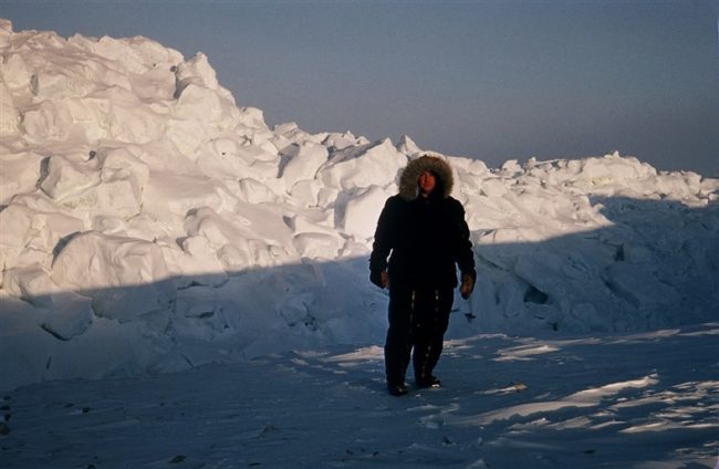
- Woody Little & ice pile. Feb 1957.
-
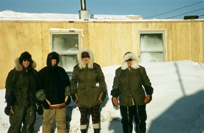
- L to R: L. Westbrook & W. Smith. Feb 1957.
-
- L to R: Hoppe, W. Little, & R. ‘Hunky’ Colbeck in one of the module train bedrooms. Feb 1957.