
DEWLINE HISTORICAL DESCRIPTION
Topography
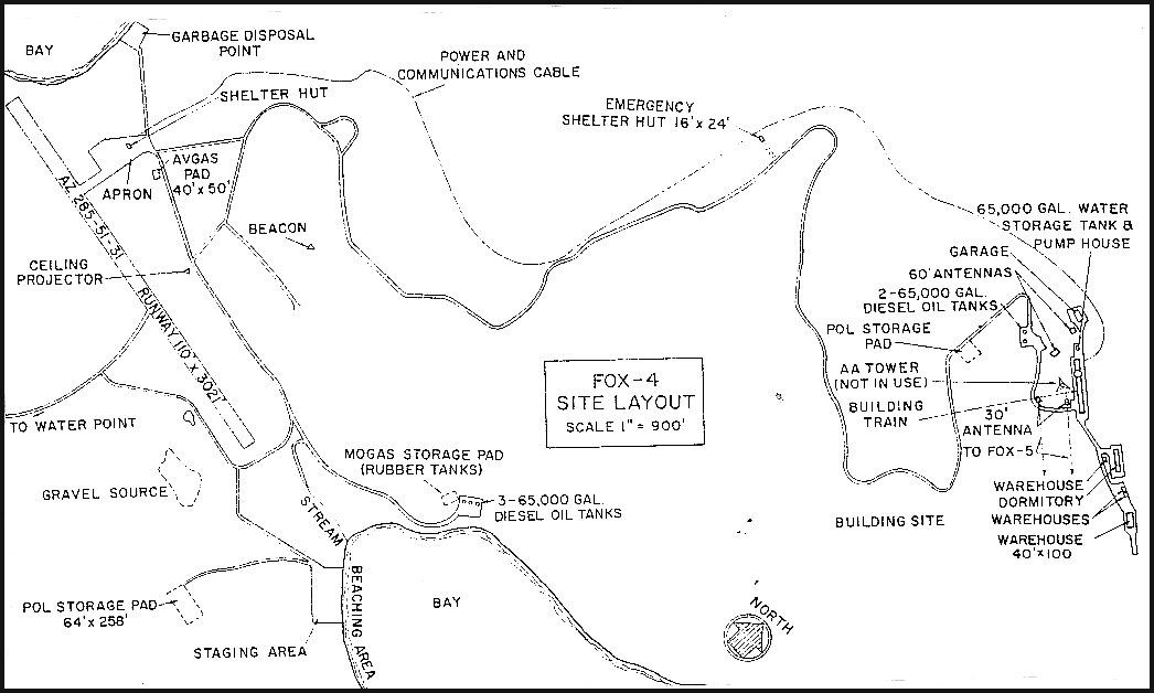
- FOX-4 at CAPE HOOPER, Canada, is situated at an altitude of about 1400 feet above sea level, on the top of a large knob of rock. This Auxiliary Radar Station occupies 2218 acres on the rugged fjord-indented eastern coast of Baffin Island. It is the westernmost station in the DYE Sector. Cape Hooper is the most commonly known geographical feature in the area. It forms the easternmost extremity of a very irregularly shaped peninsula which lies between Nadlung Fjord in the south and Home Bay in the north. The station is on a small northeasterly projecting finger of land lying on the north coast of the peninsula about 4 miles west northwest of Cape Hooper. At the station site, the land slopes away steeply on the north and south sides of the knob hill. A small inlet lies to the south which may have been the result of glacial action. There are small moraine-like accumulations of sand, gravel, and boulders of various sizes in the area.
Climate
- Annual precipitation including snowfall is approximately 8 inches, being heaviest from July to November and least in March. Snowfall, greatest in October and November, is about 64 inches a year. The absolute minimum and maximum temperatures are minus 42 and plus 66 degrees Fahrenheit respectively.
Water
- Normally, there is no winter water haul. During summer, a 7 mile round trip potable water haul is maintained. the winter water supply is stored in a 65,000 gallon steel tank. Freezing is prevented by circulating warm water from the module train through the tank..A hot water boiler of 45,000BTU per hour capacity is required to maintain the water fluidity.
PHOTOS
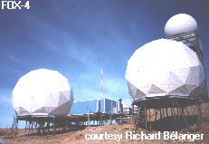
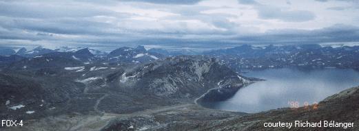
Panoramic view, courtesy Richard Bélanger.
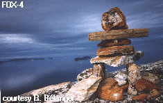
Inukshuk, courtesy Richard Bélanger.
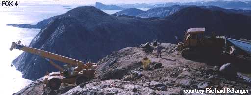
Taken during DEWLine cleanup at the upper site dump. Courtesy Richard Bélanger.
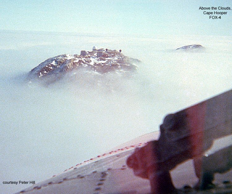
Peaking through the clouds 9/7/1978. Courtesy Peter Hill.
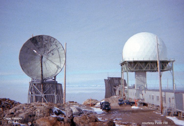
Site photo 9/7/1978, courtesy Peter Hill.
Construction Era Photos for FOX-4.
The pictures below were selected from the extensive collection of Markham Cheever, the DEWLine’s Superintendent of Construction from 1953 to 1957, before the Line went operational. (Click on picture to enlarge.)
-
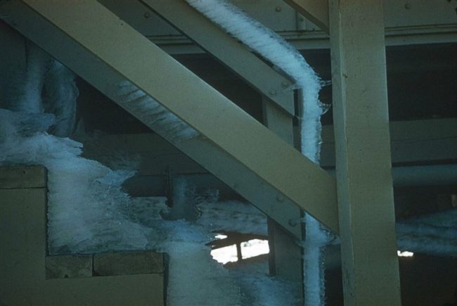
- Early morning rime ice on the steps in the middle of summer! Aug 1957.
-
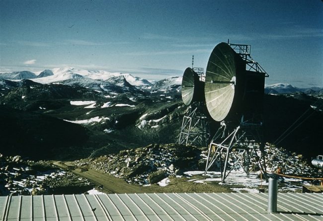
- The two-30′ UHF lateral antennas with the mountains in the background. Aug 1957.
-
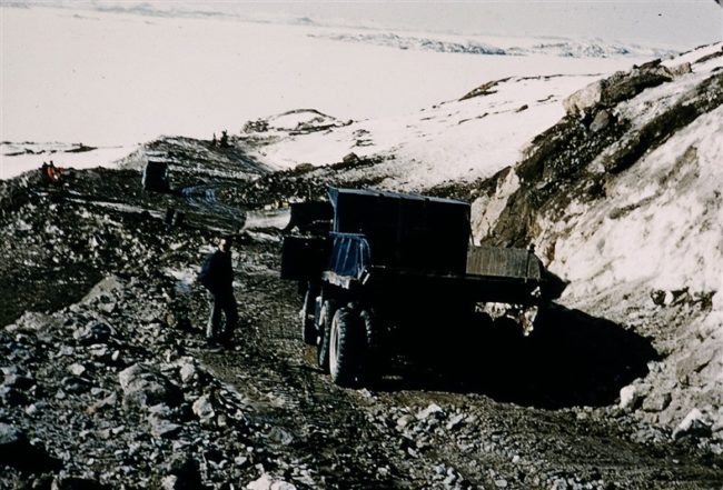
- Widening the road and digging ditches on the road from the airstrip to the site. May 1957.
-
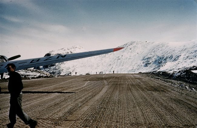
- DC-3 CF-BZN on the airstrip looking Southeast. May 1957.
-
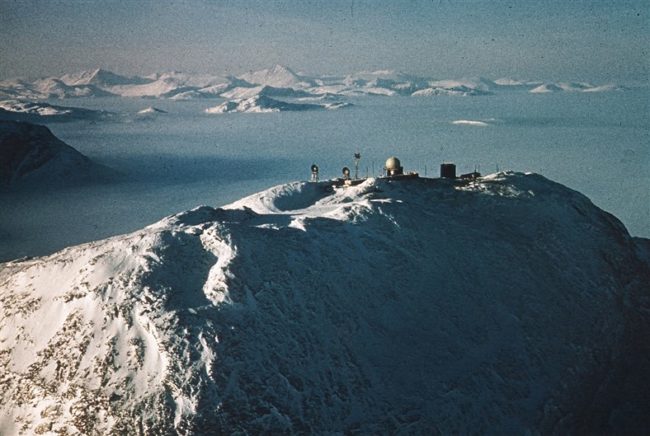
- Publicity photo of the completed station. March 1957.
The People.
The people in the photos below, also from the Markham Cheever collection, are displayed in the hopes that someone may recognize a father, grandfather, or friend who was involved in the construction of this particular DEWLine site. (Click on picture to enlarge.)
-
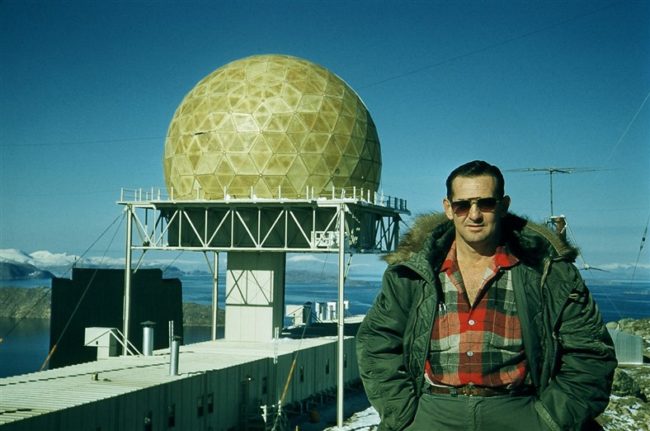
- Ken Taggart with the completed station in the background. Aug 1957.
-
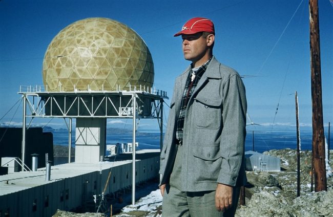
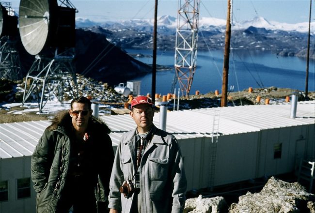
- M. S. Cheever (in his signature red cap) with the completed station in the background. Aug 1957.
-
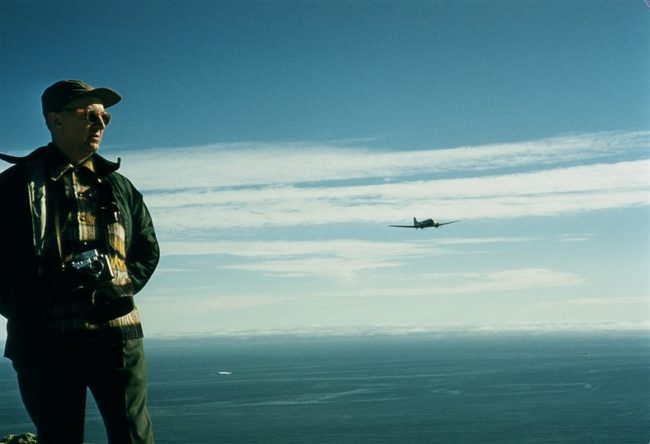
- Harry Lohman and an incoming aircraft. Aug 1957.
-
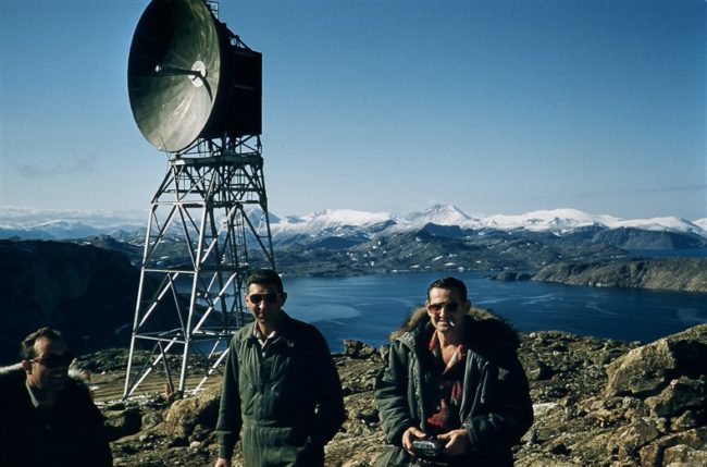
- L to R: Unknown, Major Richmond, Ken Taggart. One of the UHF lateral antennas is shown in the background.A ug 1957.
-
- L ro R: Ken Taggart and M. S. Cheever. Aug 1957.