
DEWLINE HISTORICAL DESCRIPTION
Topography
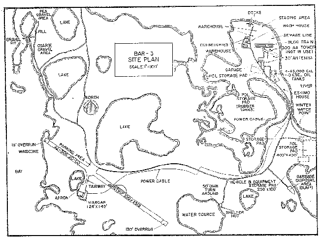
- BAR-3 at TUKTOYAKTUK Canada, is situated on 913 acres of a low peninsula, co-occupied by the Port Brabant settlement at an altitude of from 20 to 40 feet above sea level. The peninsula is extremely irregular in outline and lies northwest of Eskimo Lakes and Liverpool Bay.This Auxiliary Radar Station lies on Kugmallit Bay which cuts deep into the coast. The relief of the area is generally low with moulded hills rising to 90 feet in height. There are small lakes that vary in elevation between 10 and 20 feet. the most striking relief features of the area are the dome shaped hills called “pingoes”. Pingoes have a core of ice and occasionally measure 1000 feet across and rise to a height of 150 feet. Several are scattered to the southwest of the station.
Climate
- Annual precipitation, including snowfall, is approximately 6 inches, being heaviest in July and August and least in March. Snowfall is greatest in October and November and averages about 22 inches a year to account for approximately 54 % of the annual precipitation. Absolute minimum and maximum temperatures are minus 49 and plus 82 degrees Fahrenheit respectively.
Water
- The summer and winter potable water haul is a 2 and 1 – mile round trip respectively.
PHOTOS

Satellite Image – high level.

Satellite Image – close-up.

Photo showing DEWLine site and the new Short Range Radar (SRR) tower.

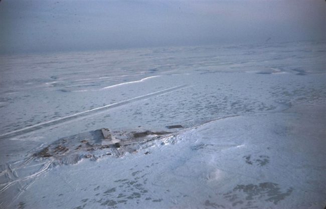
Bar-3 aerial view. Photo courtesy Dan McIsaac.

Under Construction 1956. Anybody have a radome?? Photo courtesy John S. Ross.

Tuk hanger under construction. Photo courtesy John S. Ross.

Original “Tuk-Truck” parked at Gruben Transport Tuktoyaktuk. Courtesy Richard Bélanger.
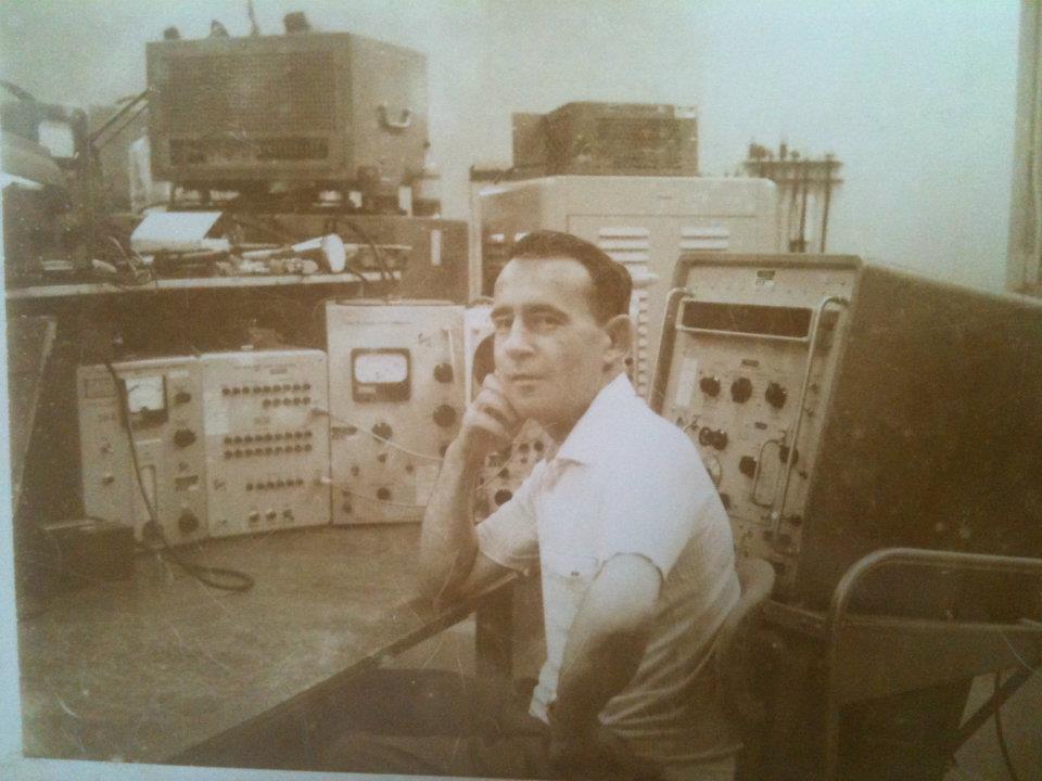
Radician James Gray at BAR-3, mid 1960’s. Courtesy Lynn Gray (daughter).
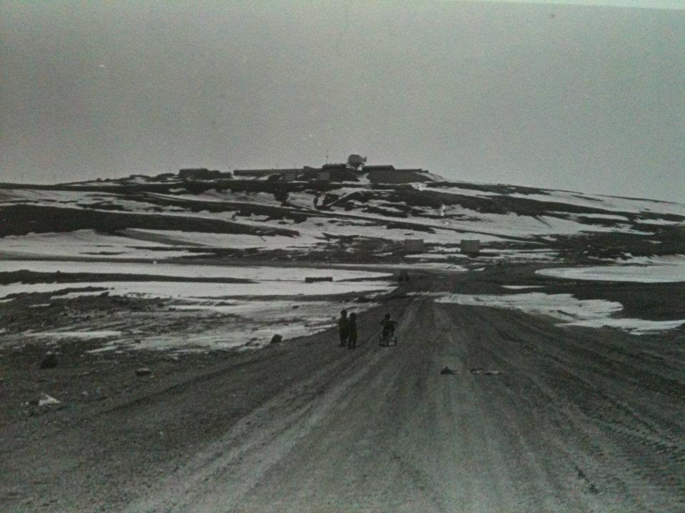
1965 picture of BAR-3. Note the aboriginal children in foreground. Courtesy Lynn Gary (daughter).
Construction Era Photos for BAR-3.
The pictures below were selected from the extensive collection of Markham Cheever, the DEWLine’s Superintendent of Construction from 1953 to 1957, before the Line went operational. (Click on picture to enlarge.)
-
- Aerial view showing the close proximity of the airstrip to the station. March 1953.
-

- Aerial photo showing the completed module train less the radar antennas and radome. July 1956.
-

- Eskimos (Inuits) getting the dog rteam ready to go. The HBC tug is on the right and BAR-3 is in the background. Jan 1957.
-
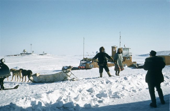
- Eskimos (Inuits) with their dog team and the Hudson’s Bay Company tug behind them and the site on the left in the background. January 1957.
The People.
The people in the photos below, also from the Markham Cheever collection, are displayed in the hopes that someone may recognize a father, grandfather, or friend who was involved in the construction of this particular DEWLine site. (Click on picture to enlarge.)
-
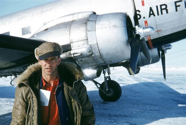
- Randy Wills with a USAF DC-3. May 1955.
-
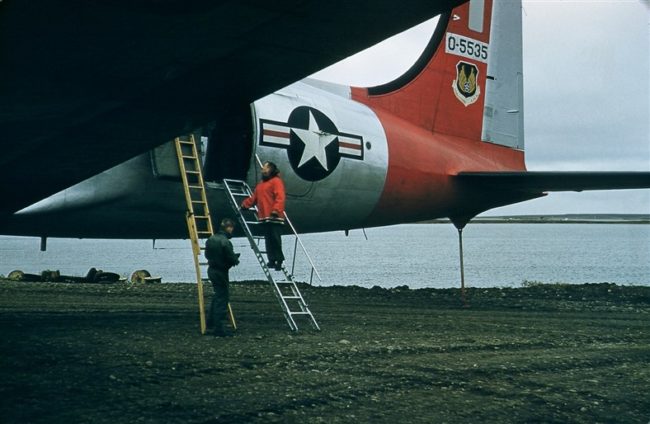
- Capt Radney on the ladder peering into the C-54 interior. Sept 1956.
-
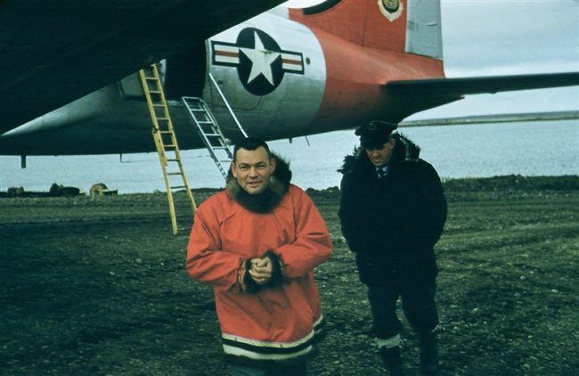
- Captain Doug Radney and unknown person with the USAF C-54 called the Dewziak. Sept 1956.