
DEWLINE HISTORICAL DESCRIPTION
Topography
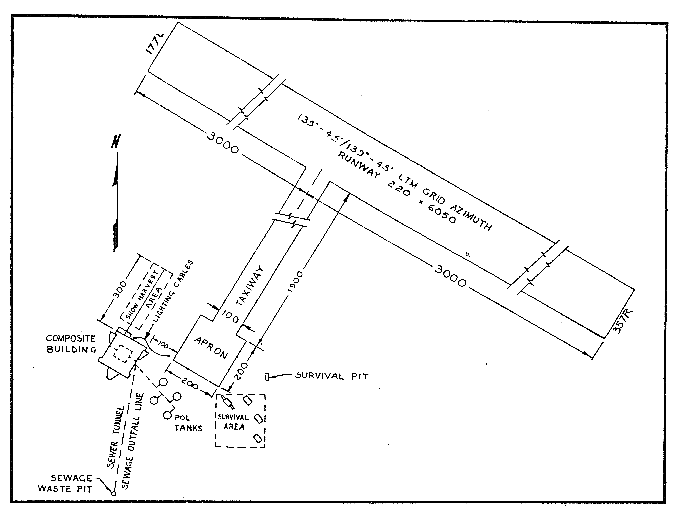
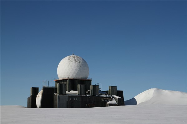
- DYE-2, Greenland, is situated on 2583 acres of ice cap territory leased from Denmark. This Auxiliary Radar Station is located approximately 100 miles inland from the west coast of Greenland about 90 miles south of the Arctic Circle at an altitude of 7600 feet above sea level. The ice cap is a relatively featureless, flat, plain-like expanse of ice and snow. The actual terrain is buried under the 10,000 foot thick ice cap. The most significant topographical feature at DYE-2, aside from the vast plain of ice and snow is the black clad Composite Building. This structure, crowned with a huge plastic radome is 6 stories high and is hung 30 feet above the snow on 8 support columns.
Climate
- High winds at the ice cap sites represent the most violent climatic phenomenon. 100 mile an hour winds have been registered. Temperature of minus 40 degrees Fahrenheit is normal during winter. Annual accumulation of ice and snow is approximately 3 feet.
Water
- Potable water is secured by melting snow, harvested with a bucket and dragline arrangement (similar to those found at stateside gravel pits) suspended from a 300 foot, variable height cable-way extending from the side of the Composite Building.
PHOTOS
Link to a photo story of The Construction of Ice-Cap site DYE-2. Courtesy Bill Lane.
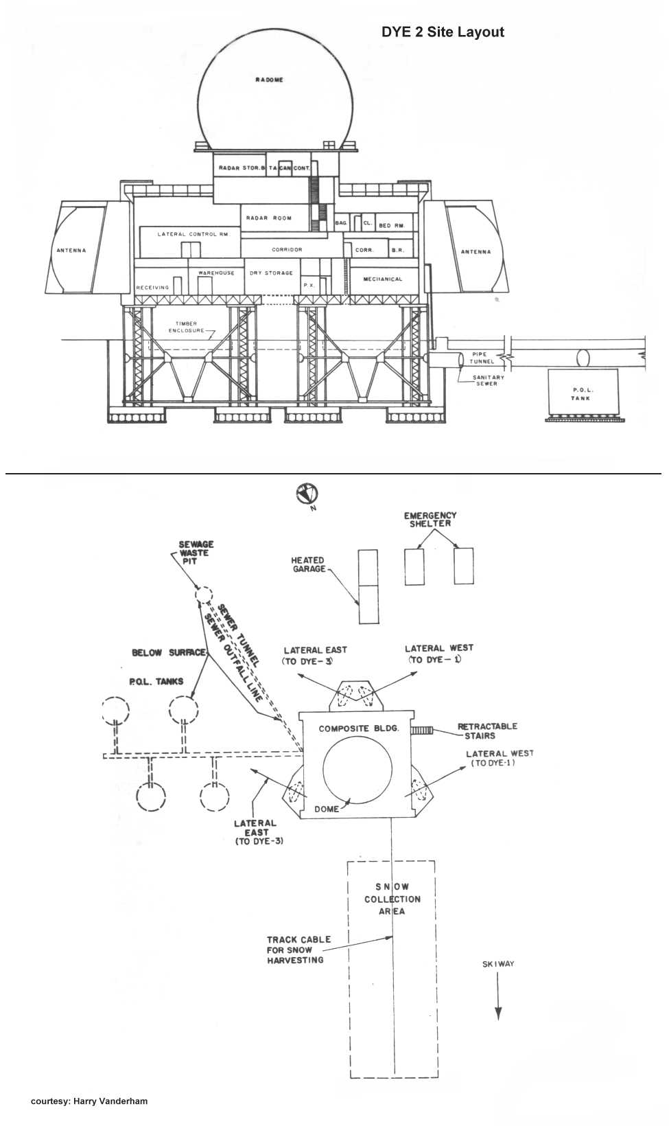
Site Layout Drawings courtesy Harry Vanderham.
As the years go by and the snowy terrain continues to rise, the site will be ultimately covered and disappear to become a frozen time capsule.
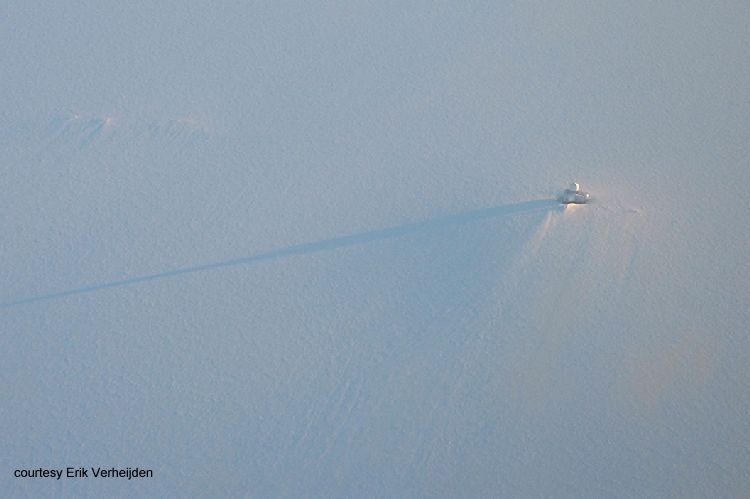
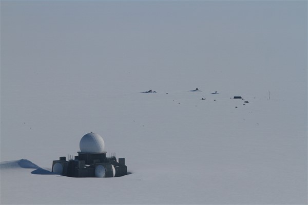
Site from 11,000 Ft. At Midday Dec 2000. Note the shadow. Courtesy Erik Verheijden.
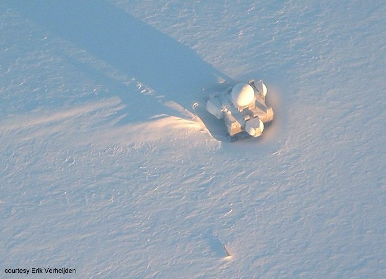
Closer view of site from 11,000 Ft. Courtesy Erik Verheijden.
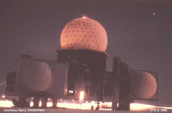
DYE-2 at night, 1966. Courtesy Harry Vanderham.
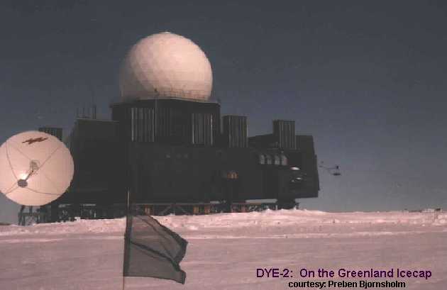
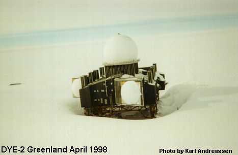
DYE-2. Another view.
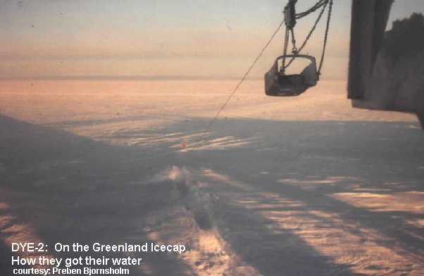
How they got their water. Drag bucket.
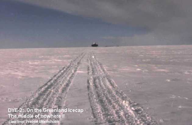
The middle of no-where!!
DYE-2: Six years after closing.
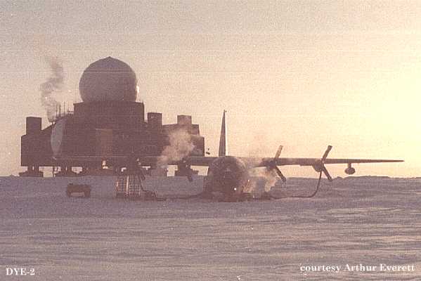
Site Photo. Tending a “Herc”.
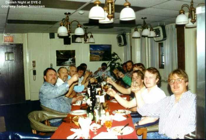
Danish Night ! Courtesy Torben Simonsen.
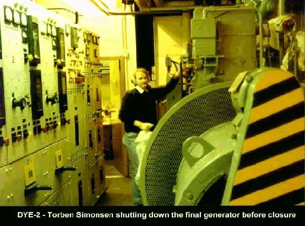
Shutting down the last generator. Courtesy Torben Simonsen.
In 2014, Toke Brødsgaard, an Air Greenland employee, had an opportunity to visit DYE-2. He and his helicopter pilot spent 20 interesting minutes at the site and took the following photos.
Approaching DYE-2. Courtesy Toke Brødsgaard. 2014.
How many more years before the site will be completely covered? Courtesy Toke Brødsgaard. 2014.
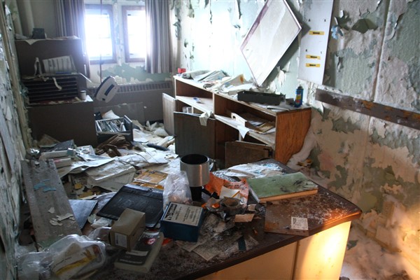
An abandoned office. Courtesy Toke Brødsgaard. 2014
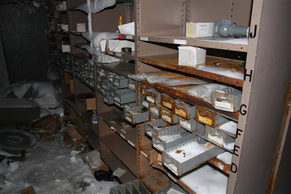
Stores area with parts still on the shelves. Courtesy Toke Brødsgaard. 2014.
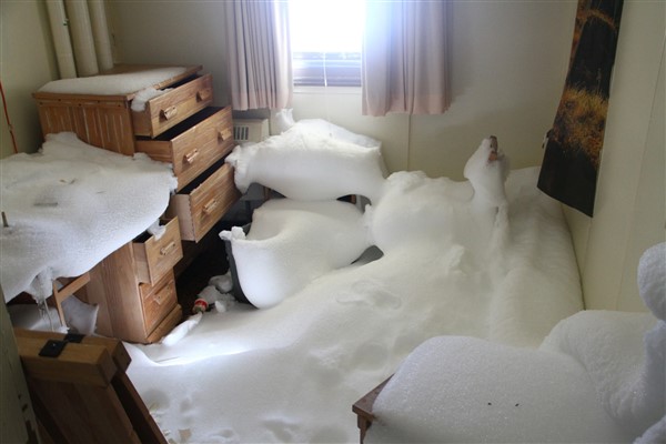
An abandoned sleeping quarter. Courtesy Toke Brødsgaard. 2014.
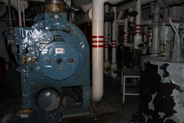
Hot water boiler, now cold, real cold. Courtesy Toke Brødsgaard. 2014.
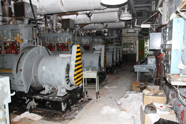
The power generation stations, now quiet and abandoned. Courtesy Toke Brødsgaard. 2014.
Story & Photos.
A link to a visit to abandoned DYE-2 in July 14-19 2003. Story by Michael Lamendola, photos by SSgt Cathy Perretta. Interesting photos from inside the abandoned building.
Video
Inside Dye-2. Have a look around inside the now abandoned Dye-2 site. It seems as if the former occupants just dropped whatever they were doing and left. (3:59 minutes).
LINKS TO INFORMATION ON THE 1982 RELOCATION of DYE-2 and 1977 RELOCATION of DYE-3
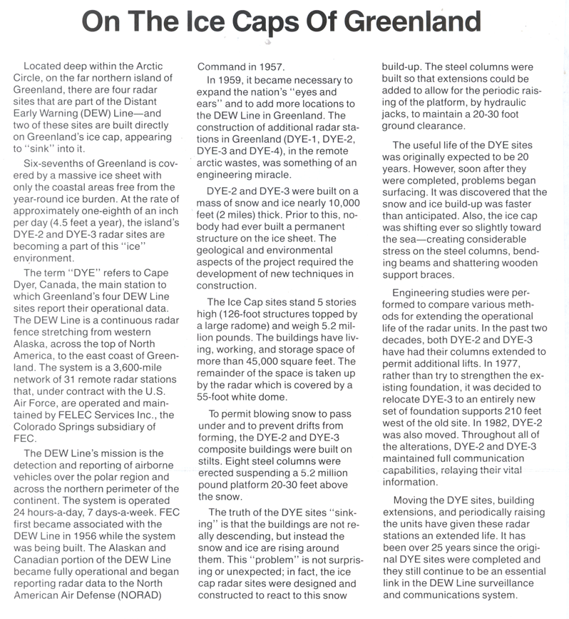
On the Icecaps of Greenland An article from a FCC/ITT newspaper
DYE-2 Abstract from the US Army Cold Regions Research & Engineering (CRREL) website
DYE-2 Milestones from the US Army Cold Regions Research & Engineering (CRREL) website
DYE-2 Summary from the US Army Cold Regions Research & Engineering (CRREL) website