
DEWLINE HISTORICAL DESCRIPTION
Topography
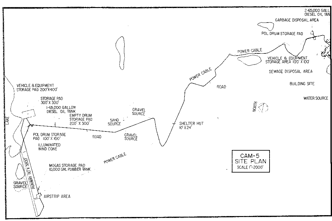
- CAM-5, MACKAR INLET, Canada, is situated on 6237 acres of extremely rugged glacially scoured terrain. The building train of this Auxiliary Radar Station is located at an altitude of 1300 feet above sea level with its airstrip some 3.5 miles away at an altitude of 100 feet. Narrow beaches line the coast. Highlands rise to about 1500 feet near the shore and increase in elevation further inland to the east where summits exceeding 4000 feet have been recorded.
Climate
- Annual precipitation, including snowfall, is approximately 5 inches, being heaviest in July, August and September and least in February. Snowfall is greatest in October and November and averages about 26 inches a year. Absolute minimum and maximum temperatures are minus 52 and plus 68 degrees Fahrenheit respectively.
Water
- The potable water haul is one half mile round trip in both winter and summer months.
PHOTOS

Site photo 1965 courtesy Bob Young.


Courtesy Bob Young, 1965.
Construction Era Photos for CAM-5.
The pictures below were selected from the extensive collection of Markham Cheever, the DEWLine’s Superintendent of Construction from 1953 to 1957, before the Line went operational. (Click on picture to enlarge.)
-

- Main road from the airstrip to the station under construction. May 1955.
-

- Summer time road to the site. Not an easy ride. June 1956.
-

- The road was improving by the Spring of 57. March 1957.
-

- The long winding road from the airstrip to the station. March 1956.
-

- Aerial view of CAM-5 module train, still without the radome. March 1956.
-

- Visiting military dignitaries to the still unfinished station. The radome has yet to be constructed. March 1956.
-

- Local Arctic fox looking for lunch. March 1956.
-

- Looking for a handout. March 1956.
-

- Professional mooch at work. March 1957.
-

- Hazards of Arctic flying. C-46, CF-IHR, overran the runway on Sept 23rd, 1956. No injuries. May 1957.
The People
The people in the photos below, also from the Markham Cheever collection, are displayed in the hopes that someone may recognize a father, grandfather, or friend who was involved in the construction of this particular DEWLine site. (Click on picture to enlarge.)
-

- Guess what’s for supper? Flanders and his catch. July 1956.
-

- Walker pointing out the ice build up on the radome guy wire. Oct 1956.
-

- Paul Fletcher outside the module train. The blue module to Paul’s right is a firebreak. March 1956.
-

- John Dille, Time-Life, at work. March 1956.
-

- John Dille from Time-Life magazine. March 1956.